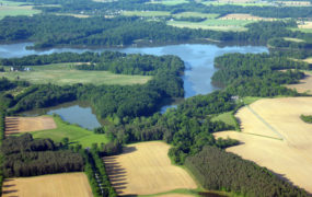
 The Upper Potomac Riparian Buffer project, conducted by Maryland Department of Natural Resources (DNR) and The Nature Conservancy (TNC) applied hydrologic-based targeting for restoration, evaluated high priority locations, and planted forests and trees to reduce pollutants and enhance coldwater fisheries habitat in priority areas of the Upper Potomac. TNC mapping identified ecohydrologically active areas (EHAs) in Allegany, Washington, and Frederick Counties, and overlaid 1-m forest cover to find potential reforestation areas, and ranked restoration opportunities for nutrient reduction potential. Meetings were held with local governments and other stakeholders to identify useful mapping products, reaching over 105 unique participants.
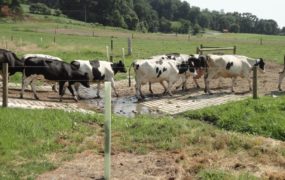
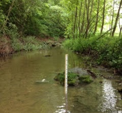
There were several on the ground outcomes associated with this project, which included: (1) 40 acres of rural riparian forest buffers; (2) 15 acres of residential buffer plantings, and (3) 15 acres of turf-to-trees and floodplain tree planting. These practices will reduce annual pollutant loads by roughly 1,400 pounds of nitrogen, 100 pounds of phosphorus, and 150,000 pounds of sediment. To keep forest in priority watersheds, the DNR developed forest stewardship plans for 4,000 acres held by private landowners. Monitoring was established to verify the targeting model and test assumptions, measuring site-scale ground- and surface-water interactions and synoptic water quality sampling for a watershed context. The project created low-cost, effective best management practices in priority watersheds and developed a widely useful tool to optimize nutrient reduction and stream shading. The field monitoring program also revealed the important (but highly variable) influence of springs on streamflow and water quality across the region, as well as an unexpectedly large number of reaches that actually lost water moving downstream rather than gaining water from the surrounding groundwater system as is usually assumed for eastern streams.